Les 2 Kirchdorf de la région de Poznan
[
www.kartenmeister.com]
German Name : Kirchdorf
Polish/Russian Name : Strozewo
Kreis/County: Kolmar
German Province: Posen
Today's Province: Wielkopolskie
Location East 16°54' North 52°56'
Google Map: Google Maps (Kirchdorf)
Map Number: 55
Location Description: This village/town is located 5.9 km and 36 degrees from Wischin, which is known today as Wyszyny
Lutheran Parish: Kolmar 1905
Catholic Parish: Podanin 1905
Standesamt/Civil Registry: Kolmar 1905
Gemeindelexikon/Town Index V-15-34
Population By Year/Einwohner: 1905: 263
German Name: Kirchdorf 1940 >
Polish/Russian Name: Jozefowo
Kreis/County: Mogilno
German Province: Posen
Today's Province: Kujawsko-Pomorskie
Location East 17°50' North 52°39'
Google Map: Google Maps (Kirchdorf 1940 >

Map Number: 3373
Location Description: This village/town is located 0.5 km and 344 degrees from Kirchlich Palendzie, which is known today as Palendzie
Lutheran Parish: D
Remarks For additional information see: Josephowo
Church: Yes


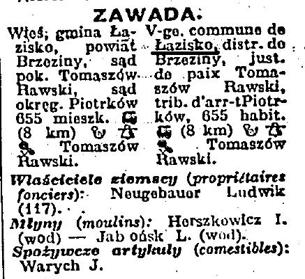
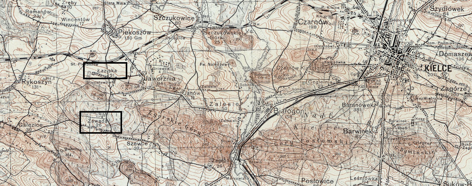
 : ma proposition rejoignait celle d’Elzbieta (Tomaszów Rawski = Tomaszów Mazowiecki)
